By 2050, around 70% of people worldwide will live in cities, as stated by the United Nations. Urbanization, limited space, pollution, and climate change are pushing urban planners to find new solutions. They aim to make cities smart, sustainable, and efficient despite changing challenges. Urban digital twins are emerging as decisive tool here, poised to revolutionize cities on a global scale.
What is a Digital Twin?
To comprehend the impact of digital twin cities, let’s begin with the basics. A digital twin is a virtual 3D model of a physical object or system. Simulating the real-world behavior, the digital replica provides a comprehensive understanding of its functionalities. Digital twin technologies use real data, mathematical models, and advanced tech like artificial intelligence, machine learning and pattern recognition.
Originating from manufacturing principles, digital twins allow for the virtual testing of new assets like jet engines. They eliminate the risks associated with potential failures during physical testing of the asset. By mirroring the characteristics, behaviors, and functionalities of their physical counterparts, they enable simulations, performance analysis, and the generation of potential enhancements.
The main objective is to gain valuable insights to optimize the performance of the original physical object. Digital twins now impact various fields, including manufacturing, healthcare, urban planning, and transportation.
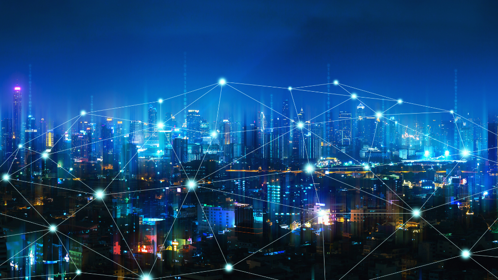
What are Digital Twin Cities?
According to the definition, an urban digital twin is essentially a virtual replica of a real city. It mirrors the urban environment, including landscape, buildings, vegetation, infrastructure, as well as the dynamic flow of people and traffic.
A digital twin city allows to simulate everything from construction to traffic patterns and energy consumption. City planners and decision-makers can derive invaluable insights into current operations and proactively anticipate future developments. Decisions have a profound impact on the future. This approach reduces trial and error in urban planning.
The digital twin of a city aggregates data sets from diverse sources, such as sensors, vehicles or mobile devices. It consists of multiple layers, each serving a distinct purpose.
The Layers of an Urban Digital Twin

The initial layers of digital twin cities recreate the city’s physical landscape, including its buildings, infrastructure, and roadways in precise detail.
The subsequent layer maps the intricate dynamics of mobility within the city.
The digital layer comes to life through the inclusion of real-time data sourced from sensors and various devices. Smart city devices and the Internet of Things (IoT) further enrich this data synthesis. The integration of AI and advanced analytics gives rise to the virtual layer of the digital twin city.
These layers combine to give a complete picture. This new perspective helps tackle future challenges and provides real advantages to city officials and residents.
What are applications of urban digital twins
So how do cities actually use digital twin cities? A primary application lies in urban planning and design. City planners utilize simulations to explore diverse scenarios, evaluate the repercussions of proposed changes, and optimize layouts for optimal efficiency. For instance, city digital twins enhance decision-making for planning, operations, finances, and emissions reduction in large construction projects, using innovative approaches.
An illustrative example is digital twin urban planning in the face of challenges such as climate change and high temperatures. This ensures that designs for the built environment are not only resilient but also sustainable. Cities like Singapore and Shanghai have embraced the concept of urban digital twins to elevate their urban planning strategies.
Digital Twin City Examples
The Singapore digital twin city offers a highly detailed 3D representation of the entire metropolis. It serves as a virtual testing ground for innovative solutions in urban planning. This includes aspects such as new construction and detailed tree and green space management, contributing to enhanced sustainability effort.
Meanwhile, digital twin of Shanghai covers an extensive area of 3,750 km². Planners in Shanghai leverage this digital representation to improve public services and model the anticipated impact of new buildings before their physical implementation.
Simulating scenarios and analyzing consequences helps to streamline the planning process and design cities with a focus on sustainability, resilience, and future growth.
Digital Twins in Transportation
Another key application area is transport planning and management. Urban digital twins offer an innovative approach for addressing the escalating complexities of urban mobility and enhancing traffic operations.
Transport Models serve as Digital Twin
This not only applies to the complete digital twin city but encompasses the mobility layer itself. A transport model, for instance, serves as a digital twin of a city’s traffic situation. The digital model reveals the complex and multimodal travel choices, movement patterns, and the corresponding demand for travel.
Moreover, it encompasses the capacities of the transport system network. Within this digital playground, transport and urban planners can evaluate the impact of diverse transportation and land use options. They can forecast the likely performance of the transport system in the future.
")
Through realistic traffic simulations, planners gain a detailed understanding of multimodal traffic flows and interactions among different road users. By analyzing multiple “what-if” scenarios, they can make informed decisions before implementing changes in the real world. These changes can include changing roads, building bike paths, or adding new public transportation options.
TfL’s Strategic Use of Digital Twin
Transport for London (TfL) exemplifies the effective use of digital twins for building future-proofed mobility. The Operational Network Evaluator (ONE), built in PTV Visum software, is a virtual copy of the real-world road traffic conditions of the Greater London Area.
It stands as one of the world’s largest and most detailed junction-based highway models. It includes 5,692 areas, 53,500 kilometers of connections, and over 17,000 intersections, with more than 5,500 having traffic signals.
TfL extensively uses the digital twin to assess the impact of schemes including cycle routes and major road redesign schemes. It also helped the operational analysis of road and river crossing closures, and their impact on bus journey times.
Real-time Traffic Management within the Mobility Layer
Furthermore, tools like the real-time traffic management software PTV Optima are used in the mobility layer of urban digital twins to monitor, control, and predict traffic. Leveraging historical and real-time data from cameras, sensors, or GPS devices, these tools enable the monitoring of current traffic conditions, incident management, and traffic signal control.
Beyond that, traffic operators use such tools to anticipate future traffic. They give authorities time to respond, improve strategies, and solve problems before they inconvenience drivers.
In conclusion, urban digital twins are poised to revolutionize the way cities are planned, managed, and experienced. This applies in particular to urban mobility.
Using the power of data and real-time analytics, cities can create efficient, sustainable and safe mobility systems. This change enables the development of adaptable transportation systems that can meet the evolving needs of people. It also promotes the progress of urban planning and management.
Related Products
Related Posts


