


Table of contents
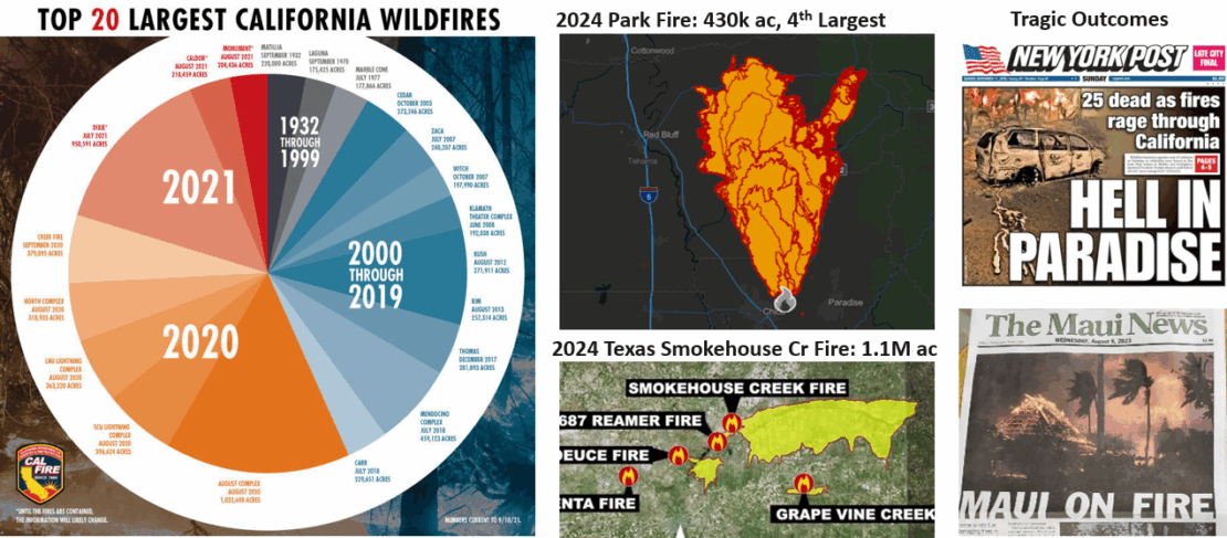
As natural disasters, particularly wildfires and hurricanes, become more frequent and severe, evacuation planning has become a critical component of emergency management across the United States. Recent events in states like California and Texas, such as the Camp Fire, the Maui and Los Angeles wildfires, and the Smokehouse Creek Fire, have underscored the urgent need for adaptive, data-driven evacuation strategies that reflect complex, real-world dynamics.
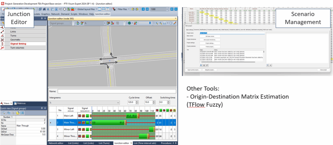
This article examines how PTV Visum’s Simulation-Based Assignment (SBA) can be used to develop robust, scenario-driven evacuation models. SBA allows planners and emergency managers to simulate time-sensitive variables, such as road closures, signal phase timing, and departure time variability. This produces more accurate, actionable evacuation plans.
Using case studies from wildfire-prone areas like El Dorado County, California, and hurricane-affected regions like Port Arthur, Texas, this article shows how Visum’s SBA supports collaborative planning, infrastructure analysis, and community engagement to mitigate risk and improve evacuation performance.
Through these case studies, we demonstrate the value of integrated modeling frameworks that combine advanced transportation analytics with local knowledge and institutional coordination.
This article is based on insights shared in PTV Talks – Spotlight Series: Emergency Evacuation Planning Using Visum Simulation-Based Assignment.
Leveraging SBA with PTV Visum
Recognizing this need, we used PTV Visum’s Simulation-Based Assignment (SBA) to create dynamic, realistic evacuation models. Unlike static models, SBA captures time-dependent factors, such as traffic flow changes, road closures, signal timings, and varying departure times, that reflect real-world conditions.
In our wildfire evacuation studies, including projects in El Dorado County, California, we created virtual incident command centers that brought together fire agencies, law enforcement, public works, and community stakeholders. These collaborative sessions helped us define evacuation scenarios based on real-world risks, such as fire origin points, spread rates, time of day, and seasonal impacts.
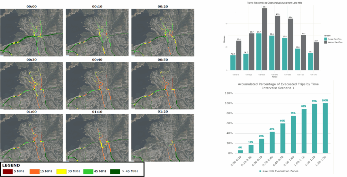
Once the scenarios were established, we used Visum to build detailed origin-destination matrices that incorporated evacuation destinations, background traffic, and potential bottlenecks. For instance, in the Lake Hills community of El Dorado County – a peninsula with limited exits – we modeled evacuation scenarios to determine how quickly residents could leave.
The software allows planners to create models of local roadway networks to identify stress points and test potential solutions proposed throughout planning processes. We constructed community models in Visum using information obtained from OpenStreetMap, community members, and local regional travel demand models.
We then loaded demand on the roadway network to simulate probable patterns for household wildfire evacuations based on input from local fire departments. We then used SBA within Visum to visualize where choke points existed on local roadway networks. Decision makers in the community could then be provided with these identified choke points to help them develop projects within their wildfire management plans that would mitigate the negative impact of a real wildfire evacuation scenario.
Real-World Case Studies
The Lake Hills community is located on a peninsula with two current routes connecting its roadway network to the rest of the county. For the evacuation scenario, a Saturday afternoon in October was chosen as the worst-case scenario. Saturday afternoon was chosen because most people are likely to be home at that time, as opposed to a weekday, when individuals are more likely to be at work or running errands.
The peninsula spans approximately 2,100 acres and features a variety of topography. Suburban neighborhoods are built within the valleys, on the mid-slopes, along the ridgelines, and on the bluffs. The peninsula is home to around 1,940 households and 5,430 people.
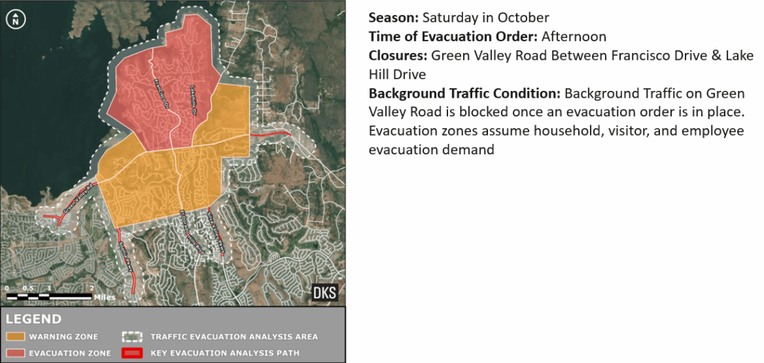
The procedure for creating the Lake Hills evacuation model first involved defining the study area and mapping the evacuation and warning zones. Evacuation zones are areas where all households must evacuate. Warning zones are areas where evacuation is recommended but not mandatory. Local fire professionals informed us about the areas that would be under an evacuation order and those that would be under an evacuation warning.
Our Visum simulations revealed important insights. In Lake Hills, even under optimal conditions, the software predicted that evacuations would take approximately 90 minutes, which exceeds the target one-hour window. Congestion worsened at key intersections as background traffic accumulated throughout the system. This demonstrates that communities with well-marked evacuation routes still have hidden vulnerabilities.
We modeled potential mitigations, including adding right-turn lanes, increasing green signal times for evacuation routes, and closing specific roads to background traffic. While these changes were modest, they had a significant impact on evacuation efficiency.
In another case, we evaluated localized hurricane evacuation bottlenecks in Port Arthur, Texas. This city faces dual threats from hurricanes and industrial disasters due to its proximity to natural gas plants. Although funding issues caused these projects to be put on hold, they demonstrated how Visum SBA can accommodate both large-scale and no-notice evacuation events.
The solutions: Strategies and infrastructure improvements
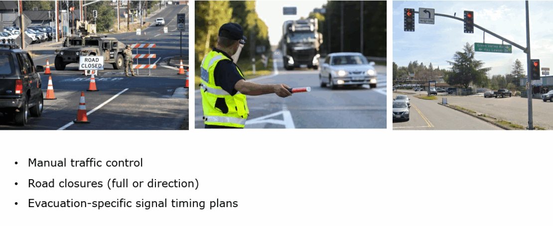
Our simulations identified problems and offered solutions. Operational strategies, such as manual traffic control, contraflow operations, and signal timing adjustments, can significantly improve evacuation flow. For example, connected signals allow us to pre-program or adjust emergency evacuation plans in real time.
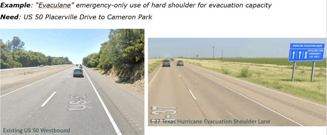
Infrastructure improvements can also play a crucial role. Adding secondary egress routes, widening shoulders, and hardening power line infrastructure can increase evacuation capacity and resilience. In areas with limited egress options, we considered using buffered bike lanes and shared-use paths as emergency routes.
We also examined evacuation scenarios involving vulnerable populations, such as those in hospitals, schools, and livestock facilities, which often require more time and resources. These elements are essential for accurate modeling and planning.
Having these plans and strategies provides local jurisdictions with important information before a disaster strikes, enabling quicker reaction times to these fast-moving disasters.
Community Engagement
Community engagement is a critical aspect of our approach. We collaborated closely with local stakeholders and used tools like Social Pinpoint to collect feedback. For example, a community member suggested closing an upstream road to divert traffic onto a main evacuation route. When we modeled this scenario with PTV Visum, we found that it significantly improved evacuation times, which demonstrates the power of local insights.
Our public outreach efforts, including meetings with fire safe councils, presentations at local events, and direct engagement with residents, helped ensure that our models and strategies reflected real-world needs and concerns. These collaborations build trust and ensure that evacuation plans are practical and community-approved.
Key Takeaways
Our experience using PTV Visum’s SBA for wildfire and hurricane evacuation planning has reinforced several critical lessons.
- Disasters are increasing: Wildfires, hurricanes, and industrial risks require robust and adaptable evacuation plans.
- Dynamic modeling is essential: SBA captures the time dynamics of evacuations, enabling us to test multiple scenarios and identify bottlenecks.
- Infrastructure and operations must work together: Combining targeted infrastructure improvements with operational strategies maximizes evacuation efficiency.
- Community input is invaluable: Local knowledge often reveals practical solutions that improve evacuation outcomes.
- Technology enhances preparedness: Connected signals, sensors, and real-time monitoring tools are critical for responsive, data-driven decision-making.
Integrating these approaches allows us to create evacuation plans that save lives, reduce risks, and build more resilient communities.

How to best use traffic simualtion
We clarify the most important questions around traffic modeling and simulation
How to best use traffic simualtion
We clarify the most important questions around traffic modeling and simulation
Related Posts


