To alleviate traffic congestion in the metropolitan area, the city of Bilbao in Spain has initiated a significant construction project: the development of a tunnel underneath the Nervión River at the Bilbao estuary. In the run-up to the project, planners have employed multimodal transport modeling and simulation to assist in designing the new subfluvial tunnel.
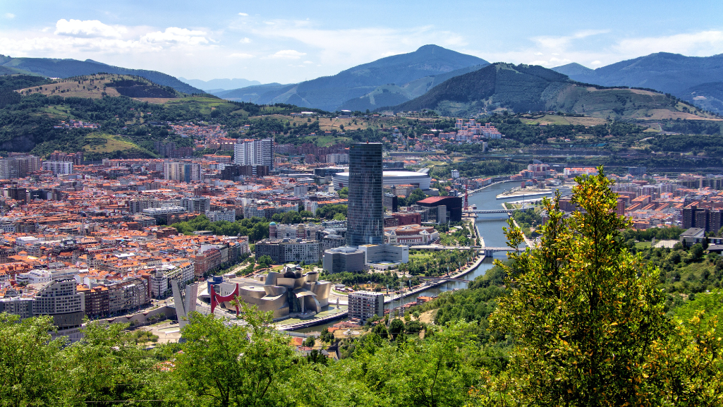
Bilbao, the capital city of the Basque Bizkaia province in northern Spain, has emerged as a shining example of successful transformation from a heavily industrialized region to a thriving and attractive tourist destination. This remarkable growth and evolution have established Bilbao as a central hub for road transportation in Bizkaia and the wider Basque Country.
The metropolitan area boasts a robust transportation infrastructure, comprising a well-developed road network and efficient public transport system. The public transport network features a metro system, connecting the city center to the surrounding conurbations on both sides of the river. It’s the backbone of the public transport system, facilitating easy movement across the region.
While the road network in Great Bilbao is extensive and advanced, its configuration is influenced by the geographical and urban characteristics of the area. As a result, certain weaknesses arise, particularly in specific sections of the arterial roads. These vulnerable sections have a significant impact on the overall road network. Any issues or problems occurring in these areas can disrupt the smooth flow of traffic and affect the entire network.
Foundation for decision-making

One specific area of concern is the Rontegi Bridge, which serves as a critical route accommodating approximately 155,000 vehicles daily. In order to alleviate congestion on the bridge and enhance the overall transportation network, there are plans underway to construct a subfluvial tunnel beneath the Nervión River. This ambitious project required extensive preliminary studies to be conducted, focusing not only on the road network but also considering the metro network.
The regional government of Bizkaia entrusted engineering consultancy Sostenibilidad y Transporte (SyT) with conducting a comprehensive traffic study to address various inquiries, including:
- What will be the anticipated traffic volume of the proposed tunnel?
- How will it impact not only the traffic on the Rontegi Bridge but also the overall arterial road network within the Bilbao Metropolitan Area?
- How would induced road traffic growth and changes in modal distribution affect the demand for public transport?
- What will be the demand for a public transport connection between the two important branches of the metro network, potentially facilitated by an automated people mover system that partially shares the road tunnel? How would the transfer conditions of different options impact estimated volumes?
To provide accurate answers to these questions, SyT utilized PTV technology. They maintain an up-to-date PTV Visum model of the entire region. This model enabled multimodal demand modeling at a macroscopic level and was complemented by detailed microsimulation using in PTV Vissim. This combination of approaches supported the decision-making process for designing road interchanges, ensuring the best possible results.
To enhance the study, SyT incorporated new advancements, such as incorporating floating car data from TomTom and mobile phone origin-destination (OD) data. These additional data sources supplemented the existing survey data and traffic counts, thereby generating comprehensive origin-destination matrices for users of the Rontegi Bridge.
The study’s reliable results served as a crucial foundation for decision-making, leading to the implementation of several considered measures. One such measure is the introduction of a people mover system that will connect the Sestao and Las Arenas metro stations. The projected timeline indicates that the tunnel will be operational by 2028, accommodating both vehicular and multimodal traffic.
Related Posts


